
Editor’s Note: Every month, DX Engineering features QSL cards from our team members’ personal collections. To highlight upcoming DXpeditions, we’ll be displaying a few of our favorite cards along with details about what it took to make these contacts. We’re excited to share some of the special cards pulled from the thousands we’ve received over the years. We look forward to seeing your cards as well!
Jan Mayen QRV in June
Jan Mayen, a mountainous volcanic island in the Arctic Ocean, will soon be a hotspot—despite its polar climate—for DXers hoping to add this entity to their DXCC list. The LB5SH DXpedition (as JX/LB5SH) is scheduled to be active in SSB and FT8 from June 22-27. As of May, the 144-square-mile island (about the size of Omaha, NE) ranked as the 84th Most-Wanted DXCC Entity per Clublog.
Similar to subantarctic and volcanic Bouvet Island—the second-most wanted entity, which is scheduled to be active in January/February 2023—Jan Mayen (IOTA EU-022) is a possession of Norway that is subject to wildlife protections. Jan Mayen has been a part of Norway since 1929; Bouvet Island has been a dependency of Norway since 1930. Bouvet is completely blanketed by glaciers while only 44 square miles of Jan Mayen’s total area is covered.
DXpeditioners and DX chasers understand that from a ham radio perspective, one of the main differences between these islands is their accessibility. As the most remote spot on the planet, Bouvet Island lies almost 8,000 miles from Norway and 1,400 miles from the closest inhabited land, Tristan da Cunha Island. Getting there requires a lengthy and potentially risky ocean journey (e.g., the crew of the aborted 3Y0Z Bouvet DXpedition began its 1o-day voyage to Bouvet on King George Island in the South Shetlands, 2,200 miles from their destination). Transport to Jan Mayen can be accomplished by ship or through C-130 Hercules military planes which periodically fly to the island. The latter was the case with Erik, LA2US, who operated on Jan Mayen as JX2US during a work assignment from October 202o to April 2021, logging around 20,000 QSOs. Excellent visibility is required for landing, though—a frequent problem since Jan Mayen is often obscured by clouds. Once on land, Jan Mayen is not without its dangers. In January 2021, two Norwegian Armed Forces employees were killed by an avalanche on the island.
Situated 370 miles northeast of Iceland, 310 miles east of central Greenland, and 620 miles west of the North Cape (Norway), Jan Mayen has no permanent population—another similarity to Bouvet. During the winter, 18 or so workers for the Norwegian Armed Forces and the Norwegian Meteorological Institute reside in the Olonkinbyen settlement located a short distance from the meteorological station and military facility. The number of people working on the island roughly doubles in the summer months.
Jan Mayen is only 45 miles from Svalbard Island. They are the only integrated parts of Norway not allocated to counties. The two islands fall under the same ISO-3166 Alpha-2 code (SJ)—the two-letter country designator established by the International Organization for Standardization. See Svalbard QSL cards here.
QSL Cards
The active hams at DX Engineering have had great success contacting Jan Mayen over the years (a good reason to contact them for help with your gear if you’d like to do the same). Here are a few of the QSL cards they pulled from their collections.
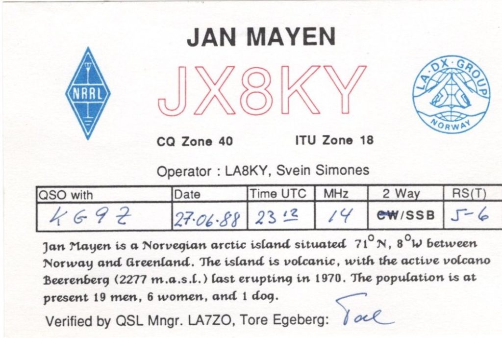
Scotty, KG9Z, DX Engineering customer/technical support specialist, made contact with the 1988 JX8KY DXpedition operated by Svein Simones, LA8KY. The card notes that the population at the time consisted of “19 men, 6 women, and a dog.” The card also mentions the Beerenberg volcano, which erupted after a long stretch of inactivity in September 1970 and continued into 1971—this despite skepticism from scientists that it would ever become active again. Five craters spewed enough material to add 1.2 square miles of land mass to the island. A 40-hour eruption that began on January 6, 1985, produced 7 million cubic meters of lava. Beerenberg is the Earth’s northernmost active subaerial volcano. The earliest recorded eruption occurred in 1732.
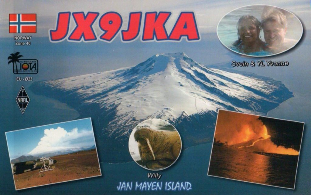
Tom, KB8UUZ, DX Engineering technical writer, received this QSL card from the JX9JKA DXpedition from Gamle Metten, the old meteorological station in operation from 1949-62 on Jan Mayen. The card includes a photo of Beerenberg in action.
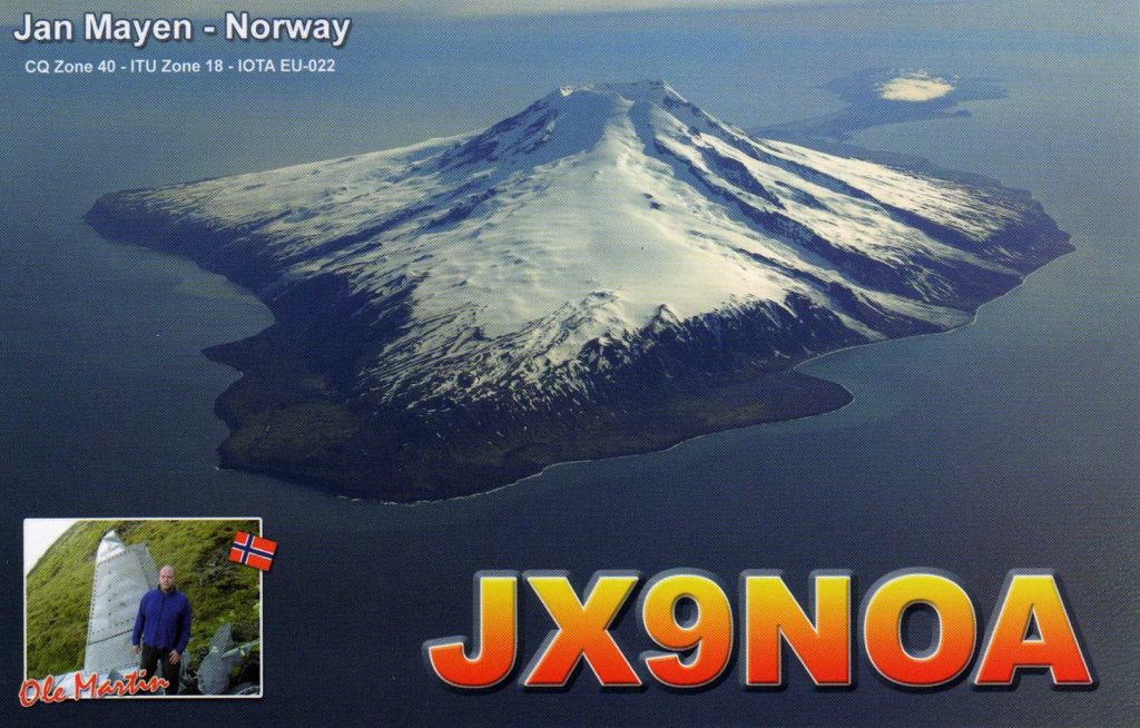
David, K8DV, DX Engineering customer/technical support specialist, received this spectacular card from the JX9NOA September 2006 DXpedition, which he contacted on 20M SSB.
Want to upgrade your DXing capabilities? The Elmers at DX Engineering are here to lend an ear. Reach out to them at Elmer@DXEngineering.com. Find everything you need at DXEngineering.com to up your game, including transceivers, antennas, amplifiers, headsets, and more.